2A - Point Cloud to BIM Services

2A - Point Cloud to BIM Services

Having successfully executed over 1000 projects, 2A is a leading BIM company with a significant presence in the digital construction industry. We invest our industry knowledge and use our client-centric approach to ensure our clients benefit from BIM and CAD in the best way possible...

2A is a BIM Design company that converts Point Cloud Data to 3D Mesh for clients worldwide including the US, UK, Israel, Germany, Luxemburg, and across Europe. A point cloud is a collection of data points in a 3D coordinate system that represents the geometry and color of an object or structure's external surface. Point cloud data is measured using 3D scanners as a collection of vector points, which are subsequently transformed into precise 3D CAD models in AEC industries. Point cloud scanning is a technique for accurately determining an area's size or layout in three dimensions.

Read more

Design With Point Cloud to BIM Services

Controlled Visibility
We will convert your raw point cloud data it into an accurate 3D model in the format you prefer. You can model pre-job topographies, progress take-offs, and As-builts using our point cloud services.
  • Metrology and quality inspection
  • Visualization, animation, rendering
  • Mass customization applications
  • Measured surveys in complicated environments
  • Elevation surveys
  • Verticality Surveys
  • In intricate structures like cathedrals, round buildings
  • In-plant rooms to record complex service runs

Detailing Geometry

Create a mesh out of the data by digitally compiling it and filling in the gaps between the points to create a solid, realistic surface and shape. Using our skilled surveyors and cutting-edge equipment, we ensure the best practices for our strong clientele including building contractors, MEP industries, AEC industries, HVAC companies, business owners, facilities, and retail.
Request a call back

Capabilities of Point Cloud Scan to BIM Services

Our BIM Modelling experts and CAD Drafters provide end-to-end solutions to clients on point cloud to 3D models. Using our great technical expertise, our Point Cloud to BIM services include:

  • Produce 2D floor plans, elevations, and sections from scanned data
  • Reconstruction of 3D surfaces from point clouds or unorganized points
  • Redesigning to retrofit the current structure
  • Using point cloud data to deliver detailed, accurate 3D models for AEC and MEP industries.

2A has assembled a carefully curated team of digital construction experts with expertise in the design, development, and operation of built assets. Our team uses their wealth of expertise to work on different file formats mentioned above and reproduces point cloud scan that is accurate. We provide services such as point cloud to mesh, 3D BIM models with required LOD 100 to 500, and 2D As-built drawings including dimensions, layers, and annotations tailored to the client’s specifications.

Point Cloud to Mesh Services Applied

3D Data Acquisition

Load point cloud data in Revit using the Automatic Point Cloud Classification which manually creates training data and then proceeds with creating an accurate automated pipeline. The Automatic Instance Segmentation allows every single instance to be addressed individually.

Object Analysis

Summarize, filter, and extract data from your point clouds down to the level of individual objects.

Conversion

The automatic scanned data is converted into a file format which is then converted into point cloud files using Autodesk Recap. The scanned data is transformed into cloud files during indexing and is further transformed into. rcp and .rcs files. Point cloud files in Revit are then linked once the. rcp and .rcs files are obtained.

Keynotes

Benefit from Scan to BIM | Point Cloud Modeling

  • Precision
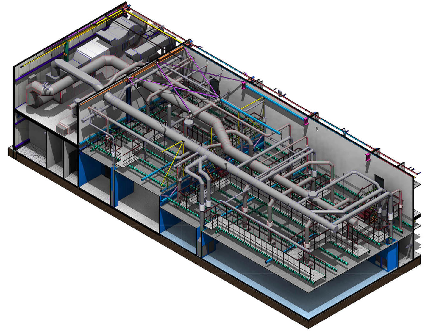
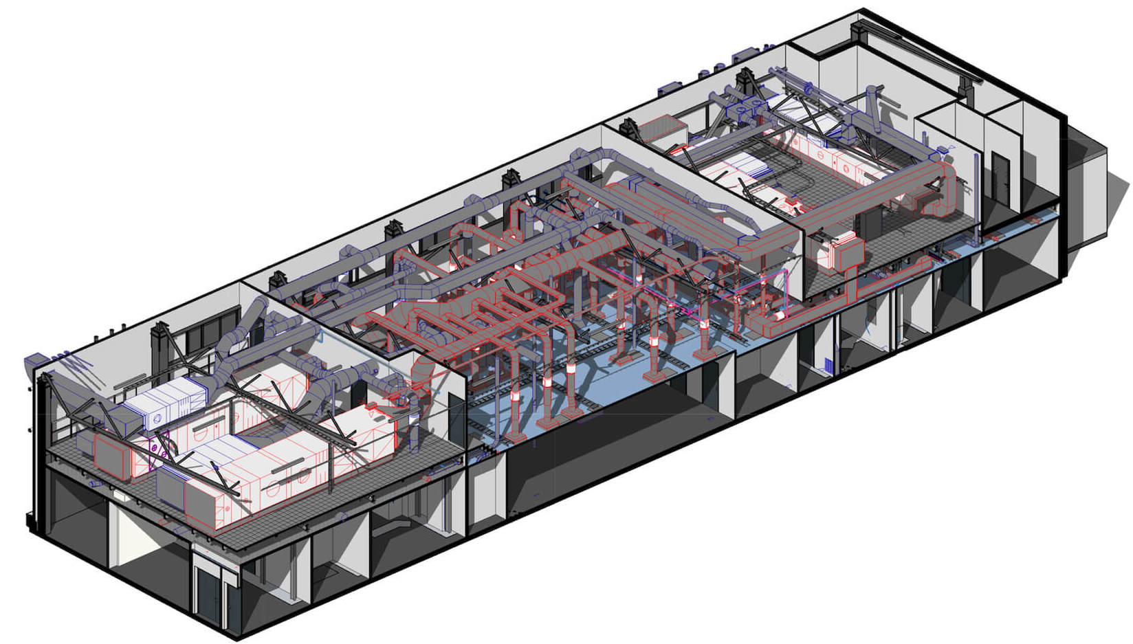
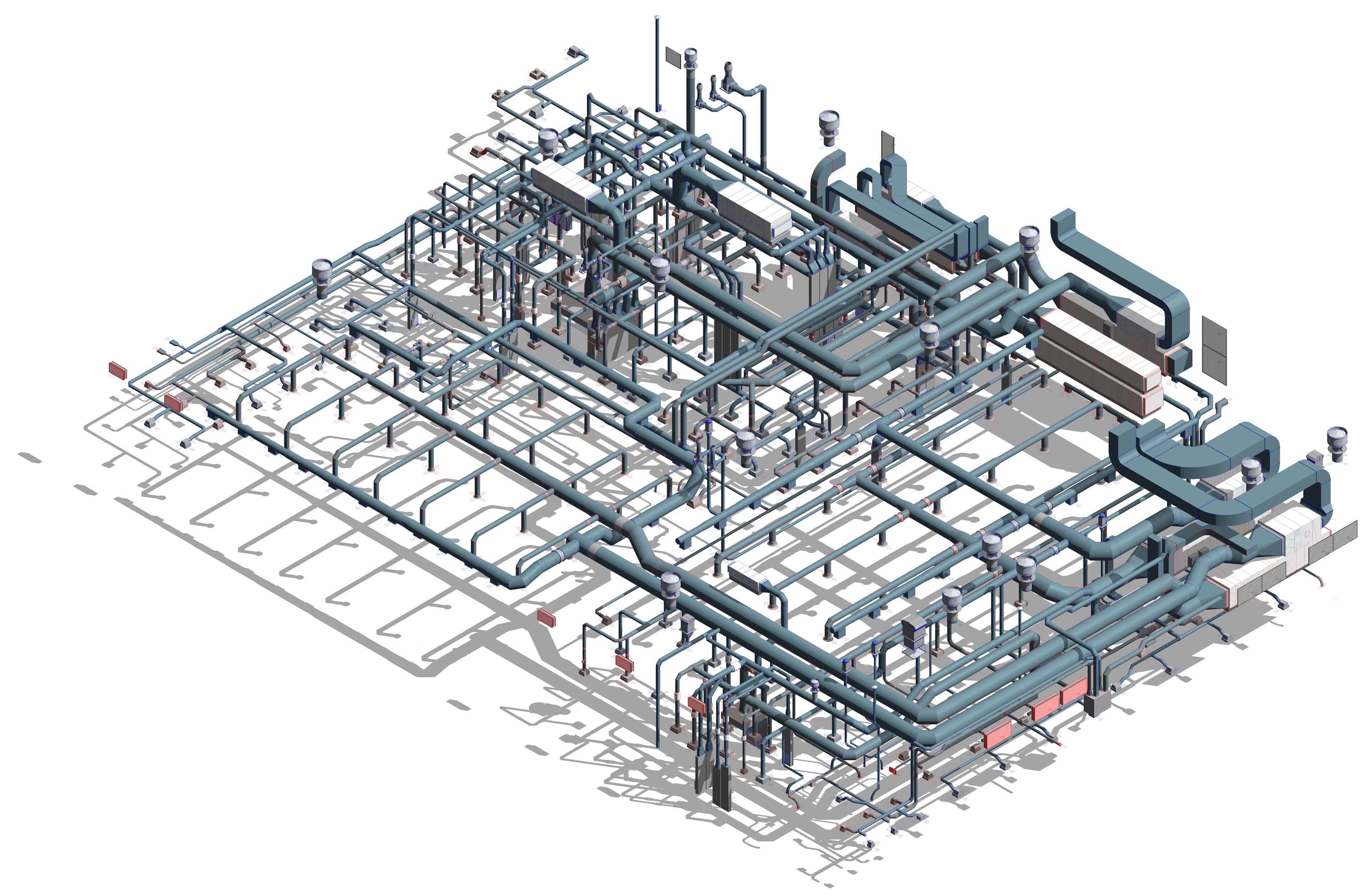
    A building or space can be quickly and accurately converted into a comprehensive 3D model using point cloud visualization software, laser scanning, and photogrammetry.
  • Efficiency
    Many points are collected at once, so data collection is quicker. The 3D model point cloud software does the work for you which saves hours. The ability to create 360-degree visual walkthroughs helps to gather additional information or measurements.
  • Cost Saving
    You can prepare a more effective budget for your projects since point cloud site mapping requires better precision.

Expert Point Cloud to BIM Services by 2A

Low pricing

Reduced costs as a result of a distributed team of architects and designers through enhanced communication, and wise management.

Complete end-to-end solution

We are capable of processing billions of laser scanned points and provide automatic (targetless) registration, denoise, simplification, and plane/pipe extraction.

Risks & Costs reduction

Multi-disciplinary professionals with years of experience are handling your projects ensuring coherence with client requirements thus minimizing risks and delays and leading to reduced extra costs.

Saves time

The ability to register numerous scans from a laser scanner could save time. Additionally, noise is significantly decreased, which facilitates data preparation.

Get In Touch